
Administrative Boundaries > OpenStreetMap
Here at GEOLYTIX we believe that the best available administrative boundaries data should be open and easily accessible. We are a little vain in respect to our maps. Badly fitting boundaries should not be crossed out.
31st March 2017 • Open Data
Unlike those maps which were used during orienteering with Napalm Death. Apart from being accurate, informative and pretty, we like our maps to be fast, and for coastal boundaries to be invisible, please.
It is likely that your base layer of choice is OpenStreetMap. Our base layer of choice will always be sourced from OpenStreetMap. It is fair to say that…
We ❤ OSM at GEOLYTIX.
The potential for OSM is huge. But being a community project, OSM can only be as good as the combined efforts of the community which supports it. We are always happy to contribute wherever and whenever possible. Not only do we try to contribute data, we also want to promote the community itself and explore new means of getting more people involved. We certainly hope that you will join us in this endeavour.
I admit that it may be intimidating to get started with OSM. Wrapping your head around the data structures can be a challenge. There are still a lot of missing maps and until a recently it wasn’t actually that easy to access the data in your GIS. But Open Source developments are rapid and Etienne Trimaille wrote the excellent QuickOSM QGIS plugin for 3liz. Libérez vos SIG indeed.
Here is me running a query that imports every Spanish Municipality border with its name and ID. This ID is the key for linking a wealth of data with a locality.
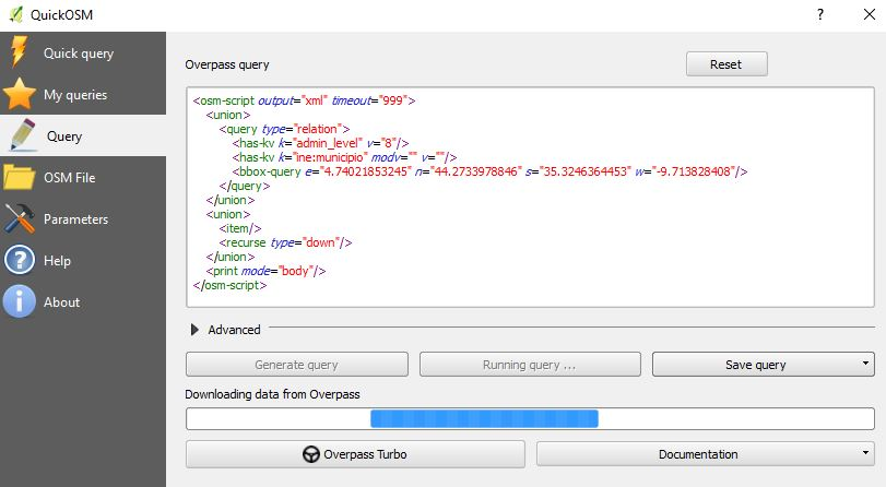
We don’t have our own overpass-api server, yet. Massive thanks go therefore to OSM-France, Germany and Russia who kindly offer this service to anyone.
The future is vector tiles.
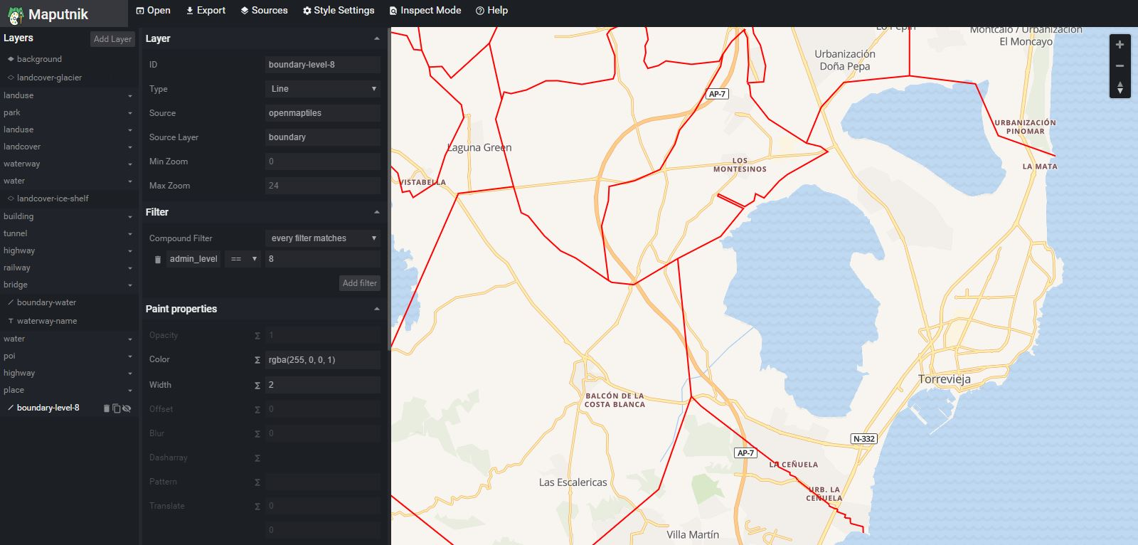
Equally impressive is the capability to style boundaries in OSM vector tiles. We will soon offer our own set of OSM styles for GEOLYTIX vector tiles. The guys at OpenMapTiles have already done the hard bits and showing us now how easy it can be to switch.
Here is a screenshot of me highlighting municipalities as easy as 1-2-3 with OpenMapTiles’ hosted Maputnik Editor. Isn’t it a treat to see the boundaries run into the ocean?
Of course vector tiles are also ridiculous fast and easy on the network.
How do we get all the boundaries into OpenStreetMap then?
It’s not going to be easy but we will try our best to get there. This will also involve a lot of manual work. More than any single person or organisation could possibly achieve. The boundaries also want to be maintained and of course boundaries change all the time. Being able to time stamp out of date boundaries is a real beauty in OSM. How much work this will be is hard to estimate. Some countries do not publish official boundaries while other countries already have most of their boundaries in OSM.
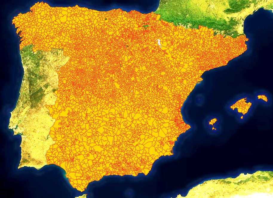
Let’s look at a case study I did for municipal boundaries in Spain. I did not have to digitise a single node. All of the boundaries already existed, but problems existed with incorrect names, codes, and admin levels. Some relations could not form closed boundaries due to missing outer ways. Other ways had duplicate associations and tags are often chaotic. A few hundred edits and 15 hours later the municipal boundaries are now complete. For the 2011 census. And only for the Iberian Peninsula and the Balearic Islands. There are still a handful of changes which happened in the last couple of years.
It will only be a matter of time before someone breaks a boundary. These accidents happen and we are looking forward to help when they do.
The idea is to write a system which automatically checks the consistency of geometry, currency and identification. This will require us to finally setup our own overpass-api server. Thereafter it will be possible to run regular automated checks. Whether each relation forms a polygon. Whether the last census data can be linked in it’s entirety via unique identifier tags. Should boundaries overlap? Are there intentional missing areas? Has the area size significantly changed since our last check?
This project is still in its infancy and every input, every bit of help is welcome. We will keep you updated. Just drop us a line if you are interested to learn more or if you want to get involved.

Related Posts
-

Grocery Growth: UK Supermarket and Convenience Changes in 2026 Q1
Convenience-led growth and selective closures have defined the UK grocery sector in the first quarter of 2026, as retailers continue to reshape their store networks.
Published 30th April 2026 • Tags open-data, geodata
-

Your Complete Guide to UK Banking Location Data
An overview of the uses of banking location data and how it can support mapping, analysis and planning across a range of projects.
Published 18th November 2025 • Tags open-data, geodata
-

Grocery Growth: UK Supermarket and Convenience Openings in 2024
2024 saw major shifts in UK grocery retail with bold expansions, innovative formats, and strategic closures shaping the industry.
Published 31st December 2024 • Tags open-data, geodata