
Interaction Surfaces: How to maximise store density and minimise overlap
If it was possible to maintain 3 successful stores in one area instead of 2, wouldn’t you want to know?
29th May 2024 • GeoData

Interaction Surfaces, the new tool available in our online platform MAPP, gives you insights into how people move around busy cities. It uses millions of mobile location data points to predict pedestrian flow in urban areas, taking the guesswork out of new site locations and impacts assessment.
But what does that mean for you? This tool is designed for location insight and property teams that are responsible for dense networks in busy urban areas. Using the probability of interaction you can see the likelihood of overlap between: your stores, your competitors, and strategic POIs like transport hubs or attractions. If you have a successful site in a busy location and a feeling there is more demand to provide for, knowing the likely flow of pedestrians could allow you to expand into previously unimaginable locations, backed up by robust data.
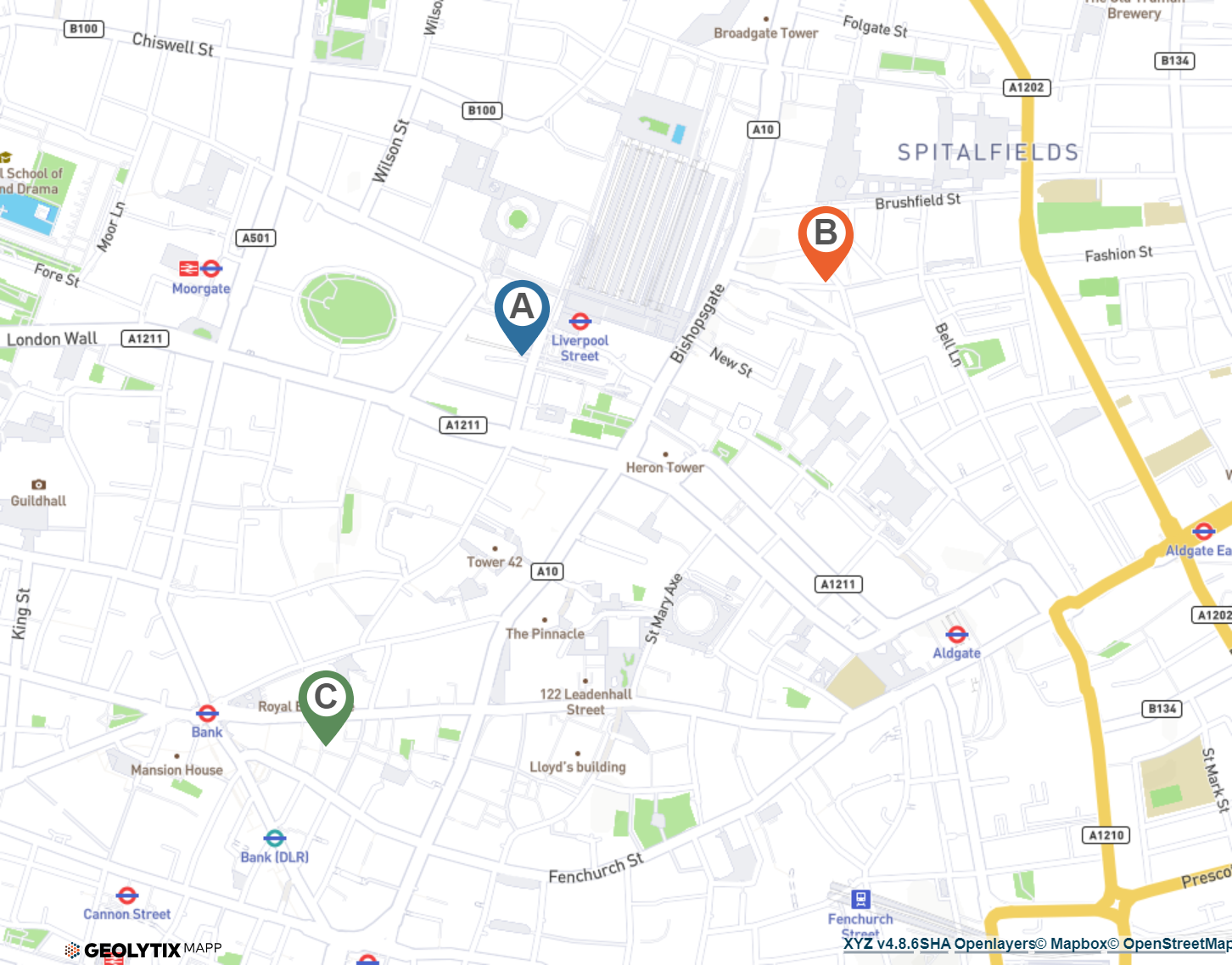
In this real example, Store A is a location nestled into an already dense network in a busy area of London. How have they pulled it off?
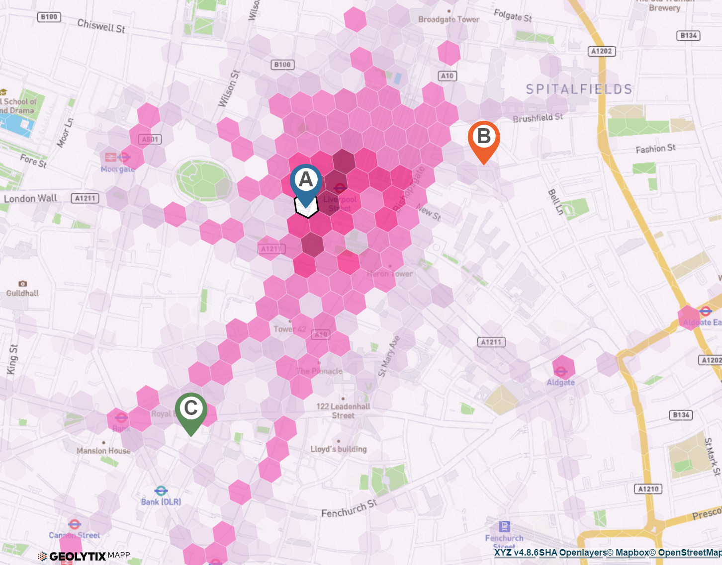
Reviewing our Interaction Surface of the new location in MAPP, we can see that the likelihood of interaction drops off sufficiently to allow all three to operate in harmony.
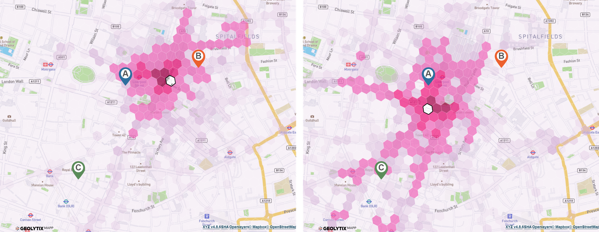
If the retailer had instead chosen Bishopsgate as a location, the interaction with their Store B becomes much higher and increases impact on the current store. If the site had been further south on Old Broad St there would’ve been the same problem at Store C.
An excellent example of dense network store planning, backed up by Geolytix Interaction Surfaces.
We’re always delighted to give you a demo of our products and talk to you about any specific needs you might have, please get in touch at info@geolytix.com.
Title Image: Photo by Anna Dziubinska on Unsplash

Related Posts
-

Beyond footfall: where retailers really outperform in London
Card spend data reveals where London retailers actually outperform their own estates. From high-conversion rail hubs to high-productivity retail parks, discover the locations driving real growth.
Published 16th February 2026 • Tags geodata
-

Your Complete Guide to UK Banking Location Data
An overview of the uses of banking location data and how it can support mapping, analysis and planning across a range of projects.
Published 18th November 2025 • Tags open-data, geodata
-

From Footsteps to Forecasts: The Power of Small Area Footfall
Discover how Geolytix footfall data can transform the way you understand your locations and identify where to open next.
Published 30th May 2025 • Tags mobility, geodata